
Your elevation data as 3D terrain, right in the browser
Orbis3D opens digital elevation models and turns them into interactive 3D terrain. Light it, colour it, measure it, compute slope, aspect, hillshade, contours and profiles, and export models, images and tables. Nothing to install, nothing uploaded.
Free and open source (MIT). Your files are processed on your own computer and never leave it.
What you can do
Orbis3D is built for GIS professionals, students, surveyors, researchers and anyone curious about terrain. The interface follows Orbis, with a workspace designed around the 3D view.
Open real DEMs
GeoTIFF and Cloud Optimized GeoTIFF, ESRI ASCII Grid and SRTM tiles, with coordinate systems, units and NoData read from the file or its .prj.
Explore in 3D
True proportions for projected and geographic data, vertical exaggeration from 0.1× to 20×, perspective and orthographic cameras, presets and smooth navigation.
Colour and light
Elevation colour ramps with classes or your own breaks, hillshade blending, sun position and shadows, wireframes, and images draped with world files.
Analyse terrain
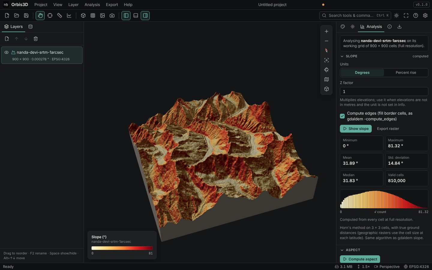
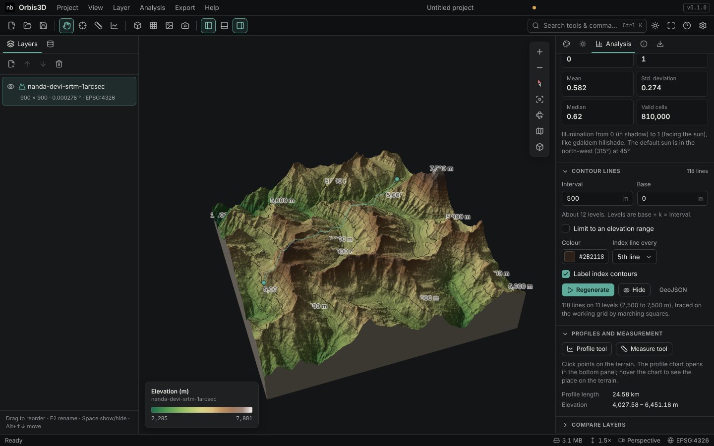
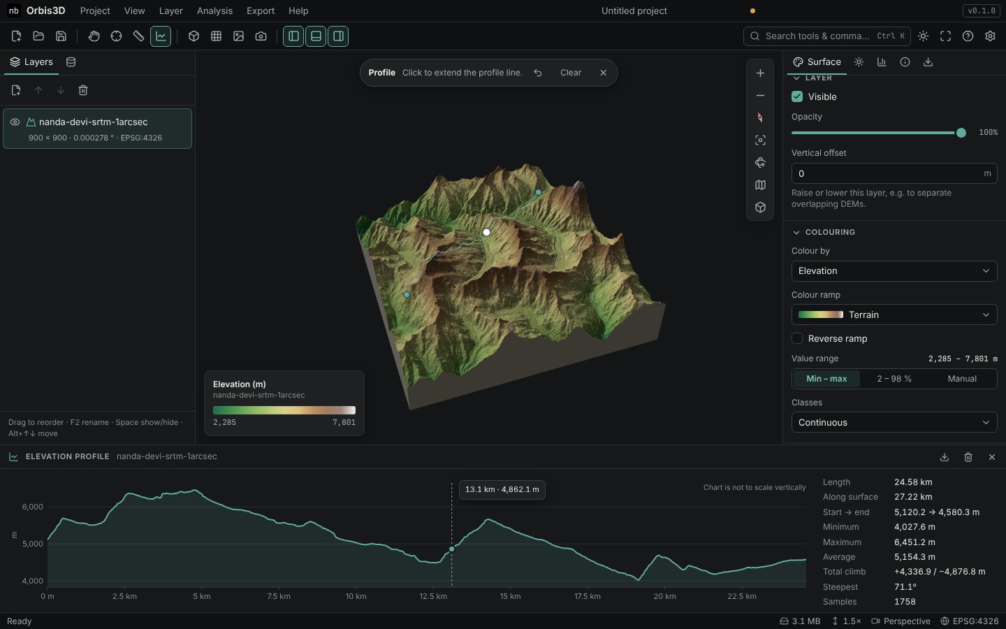
Slope, aspect and hillshade with Horn's method, marching-squares contours, elevation profiles, geodesic distances, point inspection and DEM differences.
Handle large rasters
A quick preview, then refinement within a memory budget. Overviews of Cloud Optimized GeoTIFFs are used, and exact statistics can be computed from every cell.
Export your work
GLB, glTF and OBJ models with textures, high-resolution PNG views, CSV tables, GeoTIFF and ASCII Grid rasters, and GeoJSON contours.
Save projects
Keep projects in your browser, or export a package with data and settings that reopens anywhere.
Checked results
The terrain algorithms are tested against GDAL on synthetic and real SRTM data: slope agrees with gdaldem to within 0.001°.
Terrain analysis in practice
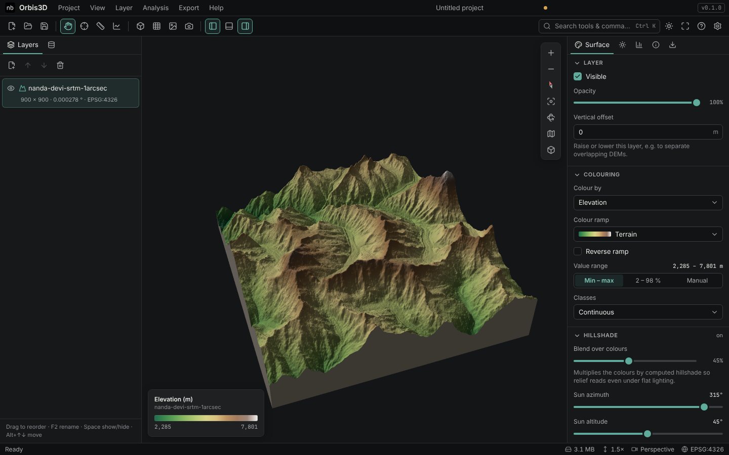
Screenshots of Orbis3D with the real SRTM elevation model of the Nanda Devi massif, one of the tutorial datasets.
Supported formats
| Data | Formats | Details |
|---|---|---|
| Elevation models | GeoTIFF, COG (.tif) | None, LZW, Deflate, PackBits, JPEG, ZSTD, LERC and WebP compression; integer and float data; overviews; band selection |
| ESRI ASCII Grid (.asc) | With an optional .prj for the coordinate system | |
| SRTM (.hgt, .hgt.gz, .hgt.zip) | 1 and 3 arc-second tiles | |
| Images to drape | PNG, JPEG, WebP, GeoTIFF | Placed with a world file or GeoTIFF coordinates |
| Exports | GLB, glTF, OBJ, PNG, CSV, GeoTIFF, ASCII Grid, GeoJSON | 3D models with textures, images with legends, tables and rasters |
| Projects | .orbis3d.zip, .orbis3d.json | Settings with or without the data |
See Supported formats for the full list and what is not supported.
Private by design
Orbis3D is a static website. All processing happens in your browser, in background workers on your own computer.
No uploads. Your DEMs and images are read from your disk and never sent anywhere.
No accounts, no tracking. No analytics, advertising, cookies or third-party requests.
Works offline. After your first visit the application is cached and runs without a connection.
Browser-based processing
Rasters are decoded with geotiff.js, analysed in Web Workers, and drawn with Three.js and WebGL 2 on your graphics processor. Large files are read in blocks within a memory budget that suits your device, with a fast preview first.
Projects you save stay in your browser's storage. Read more about privacy.
Getting started
- Open the workspaceClick Open Orbis3D. It runs in any current browser with WebGL 2.
- Drop a DEM on the viewportOr try the built-in samples: a synthetic valley and real SRTM data of the Nanda Devi massif.
- Explore and analyseTurn the terrain, change colours and exaggeration, compute slope or contours, draw a profile.
- Export and saveSave a GLB model or a PNG image, export tables, and keep the project for later.
The tutorials walk you through every feature with sample data, step by step, from your first DEM to 3D models for Blender.
Tutorials
- Getting startedWhat Orbis3D is, the interface, your first DEM and its metadata.
- 3D terrain visualizationCamera, colours, exaggeration, lighting, wireframes and several layers.
- Terrain analysisSlope, aspect, hillshade, contours, profiles, measurement and statistics.
- Advanced workflowsDraping, large DEMs, exports and projects.
- Troubleshooting and referenceFormats, browsers, performance, import problems, coordinate systems and privacy.
About Orbis3D
Orbis3D is a sibling of Orbis, the local-first web GIS, and shares its design and its approach: professional tools that run entirely in your browser. Version 0.1.0 is the first release. It is free to use and open source under the MIT licence; the source code is on GitHub.
Built with Three.js, geotiff.js, React and Lucide icons. Sample terrain: SRTM 1 arc-second data courtesy of NASA/USGS (public domain).