
Camera navigation
Rotate, pan, zoom and tilt the 3D view with the mouse, touch and keyboard, use camera presets, and switch between perspective and orthographic cameras.
You will learn
- Rotate, pan, zoom and tilt the view.
- Use presets, fit and reset.
- Choose between perspective and orthographic projection.
Prerequisites
Data for this tutorial
Nanda Devi massif, SRTM (real terrain) Download nanda-devi-srtm-1arcsec.tif
- Format
- GeoTIFF, 1 band, Int16, Deflate, tiled
- CRS
- EPSG:4326 (WGS 84, longitude/latitude)
- Content
- Elevations 2285 to 7801 m above the EGM96 geoid; lon 79.7276 to 79.9776, lat 30.2279 to 30.4779
- In Orbis3D
- Data panel ▸ Sample data ▸ Nanda Devi massif, SRTM (real terrain) ▸ Load
- Licence
- SRTM 1 arc-second, NASA/USGS, public domain
Synthetic samples are CC0 1.0; the SRTM sample is public domain. About the datasets
The task
You want to look at a valley from different directions, look straight down on it like a map, and come back to the overview.
Mouse, touch and keyboard
| Action | Mouse | Touch | Keyboard |
|---|---|---|---|
| Rotate and tilt | Drag | Drag with one finger | |
| Pan | Right-drag, or Shift+drag | Drag with two fingers | Arrow keys (after clicking the view) |
| Zoom | Scroll wheel (towards the pointer) | Pinch | |
| Fit / reset / top view | F / R / T | ||
| Orthographic on or off | O |
The camera always turns around a target point in the middle of the view. You cannot tilt below the horizon, so the terrain never disappears under the camera.
Steps
- Load Nanda Devi massif (Data ▸ Sample data).
- Drag to turn the massif. Scroll to zoom towards the summit ridge. Right-drag to move along a valley.
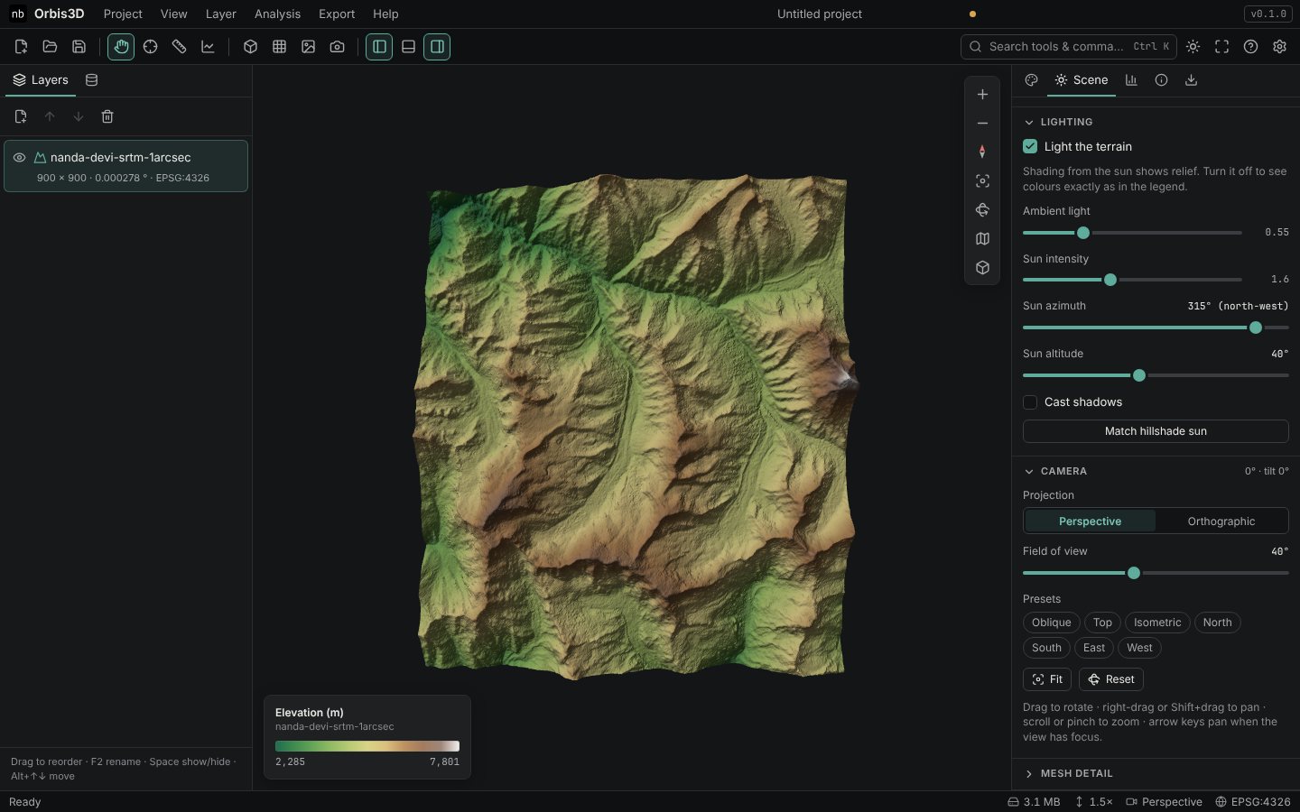
- Press T or click Top view. You now look straight down with north at the top, like a map.
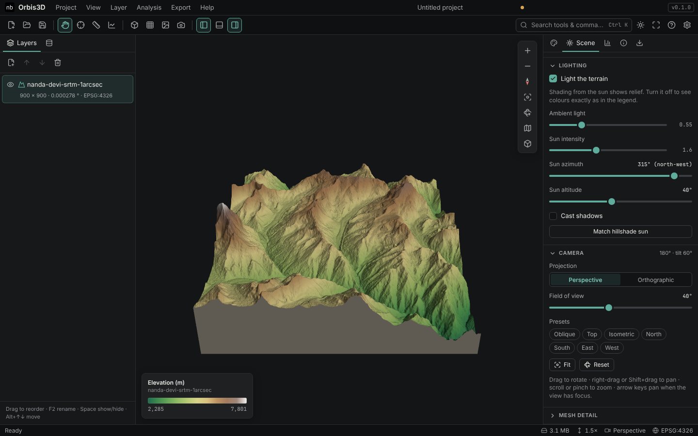
- Open Scene ▸ Camera and click the North preset. The camera looks south from the north side of the terrain.
- Click Reset north (the compass needle) to turn the view so that north is at the top again without changing the tilt.
- Press R or click Reset to return to the default oblique view. Fit keeps your viewing direction but frames all visible terrain.
Perspective or orthographic
- Perspective (default) shows near things larger than far things, as your eyes do. Change the Field of view (15° to 75°) in Scene ▸ Camera.
- Orthographic has no perspective: parallel lines stay parallel and size does not change with distance. It suits technical figures and top views where you want to compare distances on screen. Zoom changes the scale instead of moving the camera.
Expected result
You can fly around the terrain, look at it from above and from each side, and come back to the overview with one key.
Common mistakes
- Arrow keys do nothing. Click the 3D view first so that it has the keyboard focus.
- Lost in a valley. Press F to fit all terrain or R to reset.
- Top view "rotated". Presets frame the terrain; if you then drag, the view rotates. Press T again.